 Known as Old Delhi to most people living in Delhi, and as the Walled City to officials, even though there are many older Delhis, and the town wall survives only in fragments, this area is perhaps more accurately called Shahjahanabad; as both terms above include the Sadar Bazaar, which is in fact outside the wall.
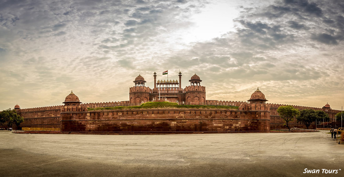
It was the oppressive heat of Agra that decided the Emperor Shahjahan to move the capital back to Delhi. In 1638 he built the Fort Palace (today called the Red Fort), which was the focal point of a new city named after him. Later, the great Jama Masjid was erected on a low hill southwest of the palace. The two axes of Chandni Chowk (running east-west) and Faiz Bazaar (today Netaji Subhash Marg, running due south) were laid out. The rest of the city was built by infill, and building work in Old Delhi has never quite ceased. Since the 1970s more and more people have been concerned at the deterioration of the urban fabric of this Mughal city, and have pleaded for the need to conserve its distinctive features. What follows is an attempt to convey the quality of life here, rather than a building-by-building description. Like all old settlements, Shahjahanabad should not be seen in a hurry, and a part of the day should be set aside for it. Only by walking through it will you under-stand its human scale. Shahjahanabad lies on the Grand Trunk Road which crosses the country from Lahore to Bengal; travellers and caravans from the west entered the city by the gate appropriately named the Lahori Gate (today, only the name survives). Those coming from the east crossed the Yamuna by a pontoon bridge or sailed past the fort and entered the city through the northern gate, the Kashmiri. Some of the other gates —Kabuli, Ajmeri, Delhi — pointed in the direction of those towns. Book Delhi sightseeing tour by car with Swan Tours at best price and discover old Delhi. This little city, focal point of a large empire, was an island in a green sea of fields and woodland, with a skyline punctuated by minarets. In the 1860s the British Government crassly drove the new railway line through the city, with a defiantly neo-Gothic railway station. Today's traveller disembarks in the most crowded part of the city, which they will hardly see for the traffic and the pollution. The best way to get a sense of where the city began and ended is to go north of Bahadur Shah Marg and to turn right at the Delhi Gate crossing. Delhi Gate is today an island, its height shortened by the repeated layer ing of asphalt on the roads around it. Northwards, left of Delhi Gate, is the commercial avenue of Asaf Ali Road. This follows the alignment of the city wall, which has been demolished. On the right a portion of the wall still stands, set off by a stretch of lawn. A right turn will bring you to Mahatma Gandhi Marg (Ring Road) and the Gandhi Memorial at Rajghat. Turn left and go along the Ring Road; on your left you can clearly see the line of the city. In your mind's eye, cover the stretch from the city wall with water, and imagine yourself not in a rickshaw but in a gently-moving boat. Previously the river ran along the walls of the fort, where Mahatma Gandhi Marg now runs. The Ring Road continues north-wards; after you've gone under the Mughal and British bridges you reach a huge over bridge: a left turn here brings you to the Interstate Bus Terminal. Today's long-distance travellers disembark where earlier the boats used to off-load their passengers. This area used to be Qudsia Bagh, one of the big orchards which ringed the Walled City. The Kashmiri Gate on the left marks the northern end of Shahjahanabad. The city can be entered most conveniently from either Delhi Gate in the south or Kashmiri Gate in the north. In neither case will you go through the gate, since both of them have made into islands and are protected monuments. Delhi and Kashmiri Gates are linked as part of a major north-south road which did not exist in the city as originally planned. If crowded streets worry you, you might not enjoy Shahjahanabad. On the other hand, if not you will find it a refreshing contrast to the open spaces and impersonal character of New Delhi. Shahjahanabad has not only monuments but a city fabric which, although inevitably changed, approximates to the original. It is a medieval town: in it you will recognise, not just Cairo or Istanbul, but also Chester and Heidelberg. It will not daunt a pedestrian, though there are times when a cycle rickshaw would be welcome. Cars, buses and scooters have now invaded its roads, have added considerably to the pollution and made the streets even more crowded. Asphalt, cinema advertisements and telegraph poles also now crowd in with the old havelis. Although it might now be hard to imagine there were once spreading trees and water channels along the main streets. The town was earlier divided into wards, separated by roads, each with a sense of neighbourhood based on shared ties of kinship or occupation. The charm of the place — still evident —is that dwellings, shops, restaurants and places of worship are all intermingled in its streetscape. The street was convivial, a place for celebration, for generating political excitement. The city was built right up to the moat of the Fort and spilled out beyond the gates. A great change occurred after the Uprising of 1857: the Mughal fort became British army encampment, the houses around it were swept away to create "Parade Ground", and tourists became poor sub-stitutes for the aristocracy who had pat-ronised the artists and artisans. A vast wholesale market, the Sadar Bazaar, was developed near the new railway station, to make Shahjahanabad the bustling commercial entrepot it still is. An amazing volume of merchandise is stored in very small premises and is carried away by retailers every week. Thus the Mughal capital became a thriving commercial town. The city suffered another trauma in 1947 when many Muslims left to settle in Pakistan. Many of their houses were occupied by Hindu and Sikh refugees coming in the reverse direction; many katras (covered shopping arcades) were also divided up between various families, several of which created occupations for themselves. Today, a startlingly large number of people, as well as shops and workshops, are to be found here. This density does not necessarily indicate poverty: many families live here by choice. If Shahjahanabad appeals to you, and you have a day or two to spare, it is well worth investing in Gayner Barton and Lorraine Malone's book, Old Delhi: Ten Easy Walks, an exceptionally well written guide which helps you explore various parts of Shahjahanabad without getting lost in its winding lanes. If your time is limited, it is a good idea to hire a cycle rickshaw outside the Red Fort and drive down Chandni Chowk. On the left is a microcosm of Indian religions and tolerance — a Hindu temple, a Jain temple with its famous bird hospital, a Sikh gurdwara and a Muslim mosque. After you pass the historic sweet shop, Ghantewala, turn left and double back through the narrow lane of Kinari Bazaar, ablaze with tinsel and gold braid (these touches of gold or silver are used to decorate everything from saris to the windscreens of trucks). This leads to Dariba Kalan, the jeweller's street. The shop fronts conceal houses with cool tree-shaded court-yards behind thick walls which shut off the sounds of the street. If you continue on the Chandni Chowk streets beyond Ghantewala, you will see the classical facade of the British-built Town Hall on the right. After which is the fabric bazaar of Katra Neel. The Fatehpuri Masjid (17th century) is at the end, and just beyond it is Khari Baoli (literally, the "Stepwell of Brackish Water" — but there is no sign of the well), an aromatic spice market. Opposite the Town Hall is the street of Nai Sarak, lined with booksellers, mostly catering to college students, and small printing shops. At the southern end of Nai Sarak is Chawri Bazaar that leads to the Jama Masjid. Just off Chawri Bazaar is the amazing spare-car-parts bazaar. The northern section of Shahjahana-bad beyond the railway line is a more open area, and the landscape is more "Indo-British". Indeed this marks the beginning of the British "Civil Lines", concentrated a little further north below the Northern Ridge. St James' Church was built by Col. Skinner in the early 19th century and bears the scars of the bullets of 1857. South of it, looking towards Delhi Gate on the right, is the old St. Stephen's College building, in pseudo-Mughal style; on the left after a few shops is the office of the State Department of Archaeology, with a colonnaded facade going back to the early 19th century, when it was the British Residency. It conceals the original building which was the library of Prince Dara Shikoh, the emperor Aurangzeb's erudite brother. Beyond Kashmiri Gate the road opens out to the Interstate Bus Terminus on the right and Tilak Park and Nicholson's cemetery, replete with the graves of 1857, on the left. For more information about what to see in old Delhi and golden triangle tour packages from Delhi contact Swan Tours offers family and couple holiday packages at best price.
0 Comments
Leave a Reply. |
AuthorSwan Tours one of the leading travel agnets in India Archives
January 2018
CategoriesAll 7 Must Visit Holiday Destinations In Madhya Pradesh Andaman Tour Packages Delhi Delhi Tourism Fairs And Festivals Of Himachal Pradesh Festival In Himachal Pradesh Golden Triangle Tour Package Handicrafts & Handloom Himachal Fastival Himachal Pradesh Himachal Pradesh Tour Himachal Pradesh Tour Packages Holiday Packages In India India Kashmir Tour Packages Madhya Pradesh Tours Rajasthan Tour Sightseeing In Delhi Things You Must Know When Traveling With Children To India Tour And Travel Tourist Places In Chamba Himachal Pradesh Tourist Places In Delhi Travel Travel Agent Travel Agents In India Traveling With Children To India |
 RSS Feed
